Introduction:
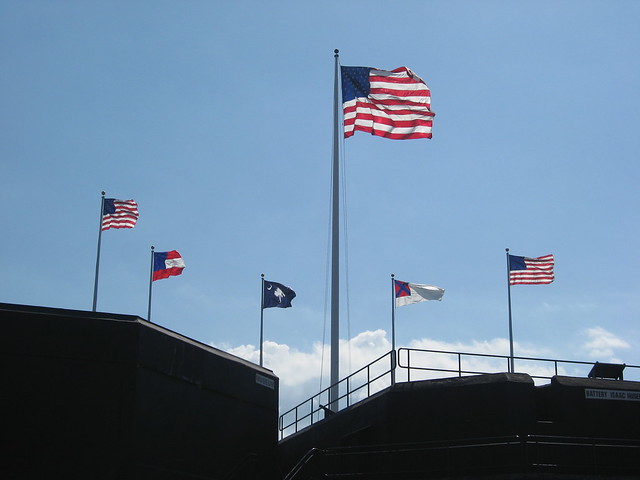
On the same trip that my wife and I went to Russell Cave National Monument we also hit up Chickamauga and Chattanooga National Military Park (Wikipedia page), since we were going down to the Chattanooga area anyway. This park is actually consists of a grouping of several parks that are in close proximity so they all fall under one name. The reason for this is that the city of Chattanooga had taken over many of the locations used in the battle after the Civil War ended so the NPS had to purchase some of the land piecemeal as well as having several things within the city itself. Another reason why it is multiple pieces of land is that there are in fact 2 main battles that took place in this area, one would eventually lead to the other but there is a gap in time in between.
I grew up as a history buff and one of the most interesting times to me was the American Civil War. As such I have been to many of the battle sites and I have always enjoyed them as they are always interesting and try to show you the scale, not only geographically but of human loss, that each site exhibits. I have been to where the war started, Fort Sumter, where the war ended, Appomattox Court House (sorry about that not linking to a post this was before I started blogging), and many places in between, including Gettysburg and many of the sites in Northern Virginia (again sorry for not having a post but those trips were also before I started blogging). Each battle has its own story and at everyone the NPS staff works to let you know not only how the battle fit into the overall story, but also how the battle fits in to the stories of individual from the war, and we aren't just talking General here but everyone down to the lowly privates.
Growing up and spending a lot of my time in the east it is easy to forget how major many of the battles of the west were. The east is where the show was, the west was how the North won the war. By the September of 1863 the Confederates were in trouble and they were starting to feel it. By this time the Battle of Gettysburg had happened and the Union had won not only there but in Vicksburg and now controlled the entire Mississippi River. The South was feeling the choke of the Union blockade and knew something had to be done. The North leading up to these battles had almost taken all of Tennessee and the marches leading to this battle would allow a Union capture of Chattanooga.
The Battle of Chickamauga would represent a slight turn for the Confederates. Union forces held the high ground and the ground easiest to defend by the start of the second day of the battle. Some costly maneuvers due to some poorly written/poorly understood orders would lead the a Union retreat that was averted total disaster by Union forces capturing the highest ground around an almost cliff like climb for the Confederates brought an end to fighting. By the next morning the Union troops had fallen back to the city of Chattanooga itself.
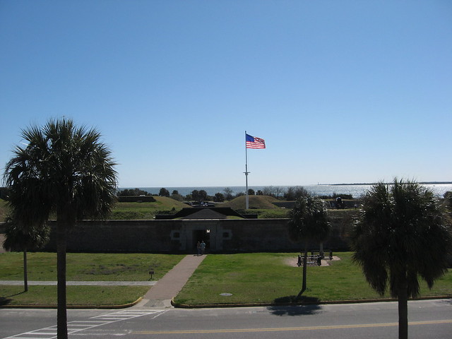
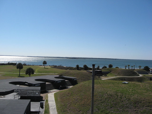
The city of Chattanooga sits at a bend in the Tennessee River and is surrounded to the south and east by high ridges. The Union stayed in the city which allowed the Confederates to put their guns in a position to fire heavily into the city. But the Union over the long run had more men and better weaponry. Eventually a commanding officer would be put in place who could handle the situation. The Union forced open a supply line which brought in fresh troops and supplies so that by the end of November the Union forces would be able to take back the hills around the city. The attack began on what is known as Lookout Mountain and eventually Union forces climbed to the top to find that the Confederates who had started the day shooting at them had abandoned their positions. The Union victory and ability to hold Chattanooga would allow General Sherman to have a supply base on his march to Atlanta and eventually to the sea.
I have been to several different types of Civil War sites and this one had a uniqueness of its own. Civil War sites in cities, like Petersburg, often feel cramped in or at least surrounded while those out in the country, like Appomattox Court House, often feel like they take forever to get to. This site has a little bit of both. You feel a little ways away from the hustle of the city while not actually being that far. I enjoyed the trip and recommend anyone in the area to head down and check it out.
Geology:

The Battle of Chickamauga was takes place in an area of low rolling hills with some areas of higher relief. The rocks in the area where the battle took place represent what is known as the Ridge and Valley Province. These rocks have been heavily uplifted as well as folded and faulted. There are also a lot of limestone in the area and this is easily eroded away to produce sinkholes or just lower areas where rivers and streams flow. At the end of the first day and beginning of the second day the Union forces held a line on a slight limestone ridge, they owed this ridge due to erosional factors that had lowered the surrounding area while the ground sloped more gently behind them. This gentle slope led the the next formation above/younger than the one they were on. While the eventual falling apart of the Union line had little to do with geology their survival is directly because of it. Where the younger higher formation has a lot more limestone in it, this means it erodes faster, this quicker erosion can cause steeper cliffs to form since the erosion is going to be faster at the edge and with a more easily eroded formation the erosion will likely start from the edge, since that is where the rock is exposed. As the Union forces retreated they regrouped up on top of a short steep ridge. This was enough for them to gain an area where they had the firing advantage and were able to hold off the Confederates long enough to form a more cohesive retreat.
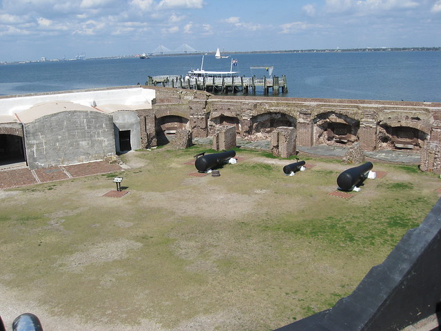
The Battle of Chattanooga is a different story though. The high ground around the city of Chattanooga is due to the ridges being caped by a layer of sandstone and/or conglomerate. These rock types are harder to erode and as such will stand up longer to erosional forces than will other rock types. The city itself sits primarily on the flood plain for the Tennessee River. These river sediments buried arrowheads and other archeological remains so that they could be found in what is now another part of the Chickamauga and Chattanooga National Military Park, in what is known as Moccasin Bend, we did not get a chance to go here however (mostly because most of it is closed off to the public). These ridges gave the Confederates a better firing angle on the city but they did not use them well enough as supply lines were eventually opened. Under the sandstone layer are more layers of limestone this is why the sandstone in this location is interpreted as a river setting that temporary buried a calcite producing system, if you want to know how look at how far the plume of debris from the Mississippi River goes out into the Gulf of Mexico today. The lower layers being limestone creates really steep cliffs on the sides of the ridges and these steep cliffs make it hard to get to the top but as you are shooting down they make it hard to shoot at the people directly below you as well. This is what would eventually force the Confederates off the ridges around the city and would allow the Union to win the battle.
More Pictures: All images are by the author ask permission if you want to use them, and if you do make sure you give me credit.


Further Reading:
University of Tennessee Chattanooga (UTC) site on the outcrops of the area.
Another piece by UTC on the geology visible from Lookout Mountain. (PDF)
If you want to learn more about the history of the site visit the NPS page.
National Park Service Series Page