Location: North-central Kentucky in portions of Edmonson, Hart, and Barren counties.
Introduction:
I was originally going to hold this post off till later but in honor of Earth Day and National Park week, many parks will allow you in for free or cheap through Sunday (April 24, 2011), I figured I would get this post done early.
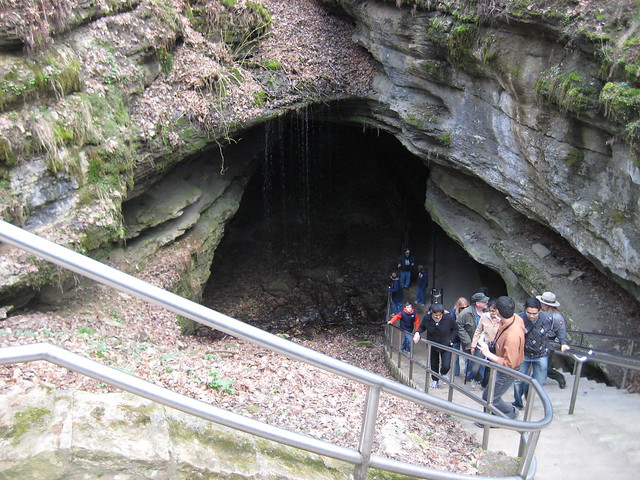
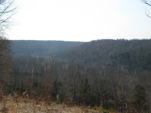
Spring Break 2011 brought me to Nashville, TN and while Tennessee itself is home to many national parks this is the closest one to Nashville. About an hour and a half to two hour long drive from Nashville, Mammoth Cave is also close to other metropolitan areas such as Louisville, KY. Mammoth Cave (Wikipedia page) was the second of the cave systems within the National Parks that I visited, the first was Carlsbad Caverns National Park. Mammoth Cave National Park covers a large area and includes many different areas to hike around outside and enjoy the mountains and the forest. Obviously, however, what the park is most known for is the cave itself which includes at least two different entrances that lead down into the cave.
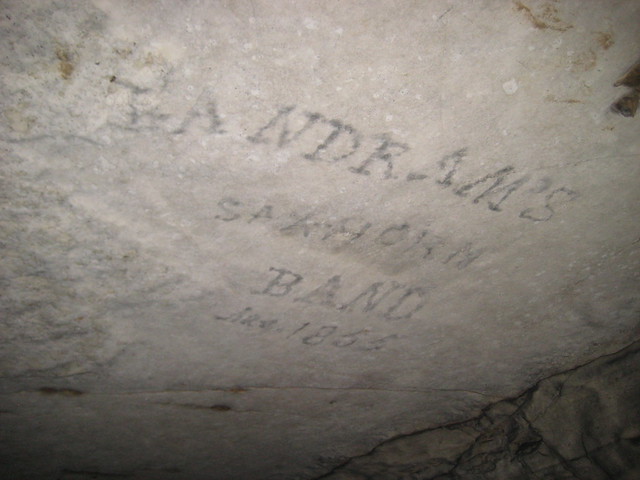
Unlike Carlsbad this cave system has been known for a long time and as you head through the cave you can see many of the markings made by some of the early visitors to the cave. These marks were made using candles on top of long sticks to allow visitors to write their names in the ash and smoke made from the candles on the roof, and since the cave environment changes very little and the marked areas do not have water in them many names that have been there since the mid-1800s are still visible. This cave has been in use in some form or another since the early 1800s and was originally used as a mine with many of the original settling basins and pipes that were worked by slaves are still visible. The one thing I didn't like about this park was that, also unlike Carlsbad, the only way to view the cave was the be led down by a National Park Service guide. This is due to the cave being more confusing than Carlsbad and the trails having been put in by the Civilian Conservation Corps (CCC) in the 1930's so the trail itself is not paved with railing around it. Overall though if you are in the area I recommend that you check out the cave.
Geology:
 I have already covered how caves form from solid rock in the Carlsbad Caverns post (click that link if you want to read more) so the geology in this post will be more about the regional geology.
If you look at the mid-western portion of the United States on a geologic map there are a lot of Paleozoic aged rocks that form the bedrock for that area. This is because for most of the Paleozoic the Midwest was sitting under a shallow sea and the Appalachian Mountains were being uplifted, for the first time, which provided sediment to be deposited in this basin. During much of the Paleozoic North America sat on the equator which provided for a much warmer climate than what is found today especially in some of the more northern states such as Pennsylvania, you can see more of this in my Guadalupe Mountains (Guads) post. Many of the southern portions of this area were not receiving high amounts of sediment though and due to the way the crust bent in the area, the Cincinnati arch, these areas, seen really well from just south of Nashville to Ohio, were shallow seas. These shallow warm seas as we know today are home to calcite secreting organism and other reef organisms. This creates a vast area in the center of the country that is home to lots of limestone deposits which creates what is known as karst topography, which is pretty much lots of sink holes and caves. All of the rock that you see in and around Nashville is limestone or other similar calcite rich rocks.
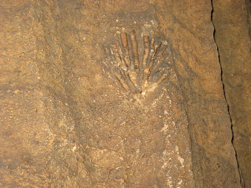
During the Mississippian, early Carboniferous, the area that is now Mammoth Cave National Park was sitting in a shallow sea and was a highly productive reef system. Throughout many areas of the cave fossil organisms that are now primarily associated with reef systems, such as crinoids [image of a crinoid fossil from the new entrance to the left], are found as fossils in some of the less altered cave walls. This led to a lot of deposition of calcite which is where all of the portions of the cave are now found. During the Pennsylvanian, late Carboniferous, there was a subtle change in the flow of sediments into the basin and a river system began depositing sand in a deltaic system over the area. The sediment from this river would choke off the ability of the reef organisms to live and produce calcite, similar to why there are no reefs near the Mississippi River delta today, and would instead allow just for the deposition of sands and clays. These sands and clays do not erode away as quickly or easily nor are they effected by acidic water the same way that limestone is so they provide a sort of cap rock preventing water from entering the system and dissolving away the rocks below.
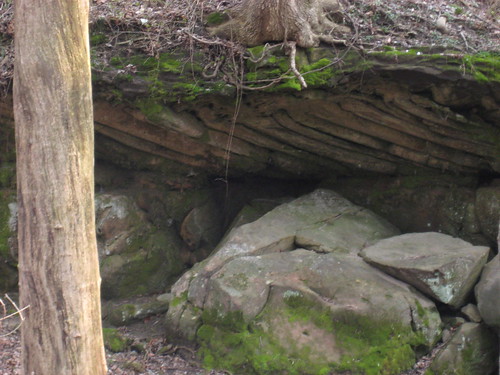 Eventually this area began to uplift as well as forms the western portion of the current Appalachian Mountains called the Appalachian Plateau. As this area was uplifted water did what it always does to areas that are uplifting, it started cutting away where rivers were flowing to form valleys, the speed of this uplift is really present in some of the eastern rivers such as the New River and the Shenandoah which appear to meander like river that are no longer down-cutting but they are still down-cutting forming deep valleys (I have the ability to cover that last one and might here soon). Within Mammoth Cave National Park is the Green River which cuts a valley and at one time was much higher up relative to where it is now. It was when it was still cutting a higher portion of this valley that most of the cave that visitors see was being formed. The cave system itself is actually part of the Green River watershed and there are vast underground flowing rivers that carry water from west of the area over to the current location of the river. At one point in the past some of the larger chambers in the upper portion of the cave did the same but as the water table fell, do to the uplift of the mountains, these portions of the cave became dry. In many places the Pennsylvanian sandstone [image at right is an outcrop of the Pennsylvanian sandstone] that formed the cap rock has been stripped away this has allowed water to continue to enter the cave and forms many of the sinkholes in the area. The places where the sandstone is still present form the ridge tops and locations within the cave that have no water dripping into them, because it cannot get through the sandstone, or does so too slowly to be noticed. This creates a stable environment that allowed for the preservation of mummies that first created the buzz for the area before it was a National Park.
More Pictures I have even more in the Mammoth Cave portion of my Flickr page.
Further Reading:
History of Geology's post on the mountains formed by prehistoric reefs (I should really have linked here in the Guads post as well).
National Park Service's webpage on the Natural Features and Ecosystems which has links to many more specialized sections of their webpage.
My post on how the NPS is trying to protect bats in the area.
National Park Service Series homepage

No comments:
Post a Comment